1520604758000
Soakaway Testing
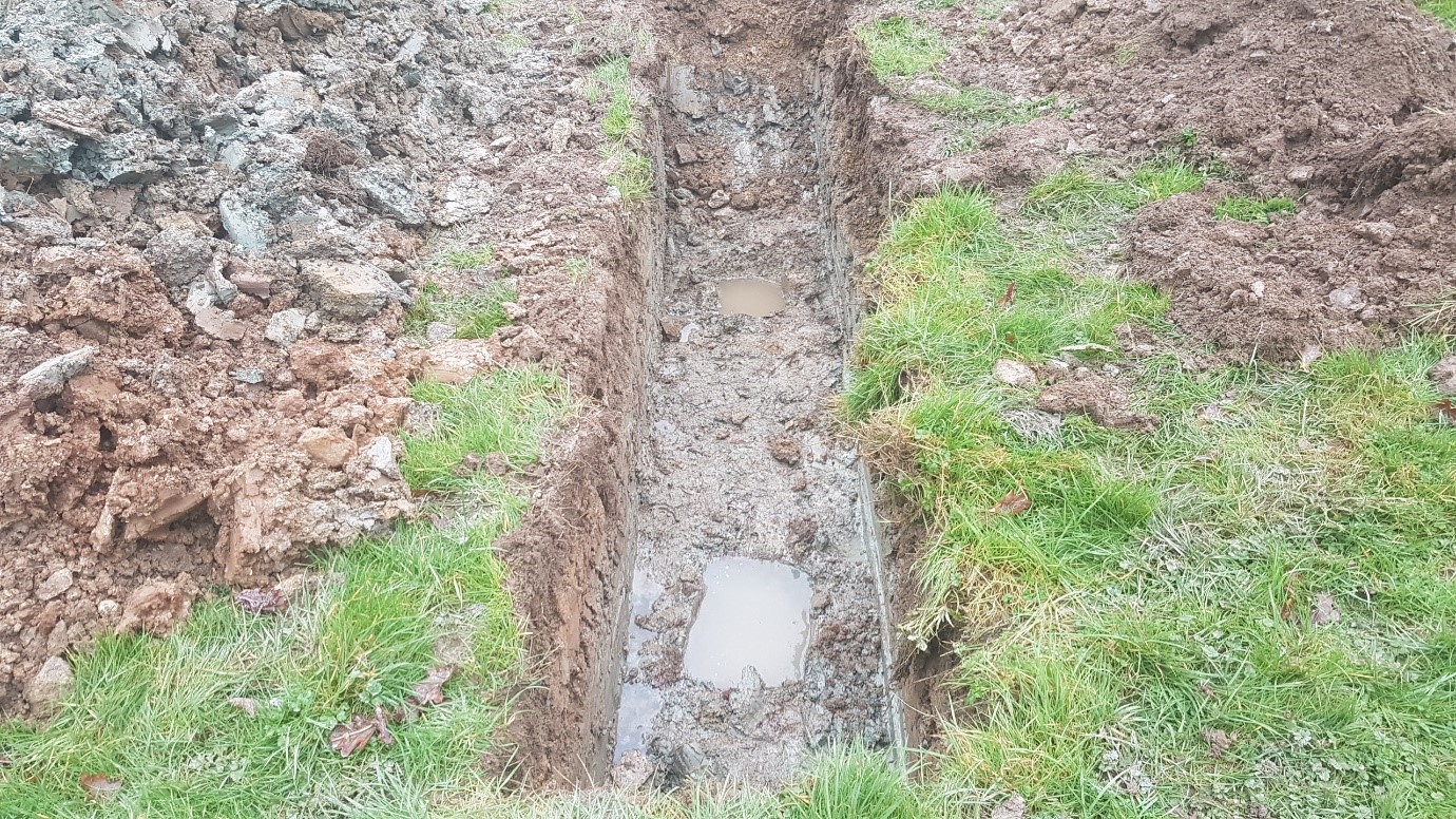
BRE Digest 365 Soakaway and BS6297 Percolation Testing, Devon To assist with planning for the redevelopment of a single residential property SWG undertook Soakaway testing in accordance with BRE Digest 635 for storm water drainage design and Percolation testing in accordance with BS6297 for septic tank soakaway design. It was a small side and so a small tracked excavator was used to access the site. Unfortunately the very low permeability clayey ground meant that soakaways were not suitable this time and an alternative drainage strategy was required.
1520604487000
Ground Gas Desk Study
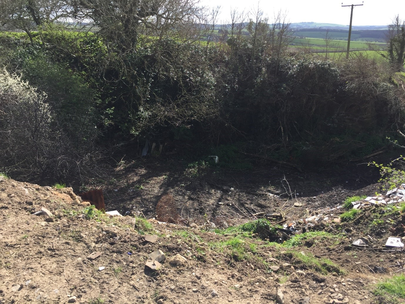
Phase 1 Ground Gas Desk Study for redevelopment of a residential property Following submission of a Planning Application, the Local Authority expressed concern about a former quarry being a potential source of ground gas which could impact the proposed development. SWG undertook a Phase 1 contamination desk study and walkover survey to assist with planning conditions to and to produce a Conceptual Model of the site and identify the Source-Pathway-Receptor linkages between the quarry (source) and the proposed dwelling (receptor). The old quarries and associated pond located 25m south west of the site have been backfilled, in part, therefore, these features presented a theoretical source of ground gas. It was determined that as the quarries are not capped, any gasses generated would vent to the atmosphere rather than migrating laterally through the ground towards the development site. SWG argued that the use of modern construction techniques and a damp proof membrane with good sealing around pipes and floor structure will provide inherent gas protection measures. The desk study was accepted by the Local Authority and relevant warranty providers, subsequently planning was granted, saving the Client time and money.
1520602284000
Desk Study
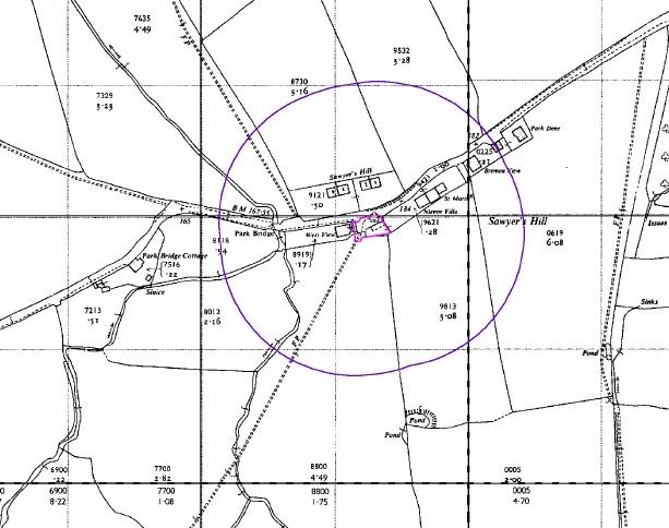
Phase 1 desk study for conversion of barn to residential property SWG undertook a Phase 1 contamination desk study and walkover survey to assist with planning conditions to identify any potential contamination on a small a small barn site that is to be converted in to a residential dwelling. A series of historic maps were reviewed along with information on industrial land use, landfills, radon and subsidence. A conceptual model was developed which did not identify any significant sources of contamination. On this basis SWG recommended the ground suitable for use for a residential property without the need for a Phase 2 contamination investigation. The desk study was accepted by the Local Authority and relevant warranty providers, subsequently planning was granted, saving the Client time and money.
1520601502000
Coal Workings
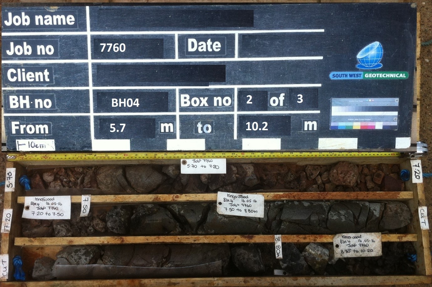
Investigation for industrial development above known coal workings, Bristol SWG undertook an investigation to assist with the purchase of an industrial estate in Bristol. The Client wanted to understand the risks associated with former coal workings beneath the site. SWG undertook a series of rotary cored boreholes with our very own Commachio 205 drilling rig to identify where coal seams has been worked. SWG produced a cross section through the site identifying areas of known workings and provided the client with advice on foundation design and recommendations, plus preliminary costs for remediation works for the future development.
1520601131000
Ground Gas Monitoring
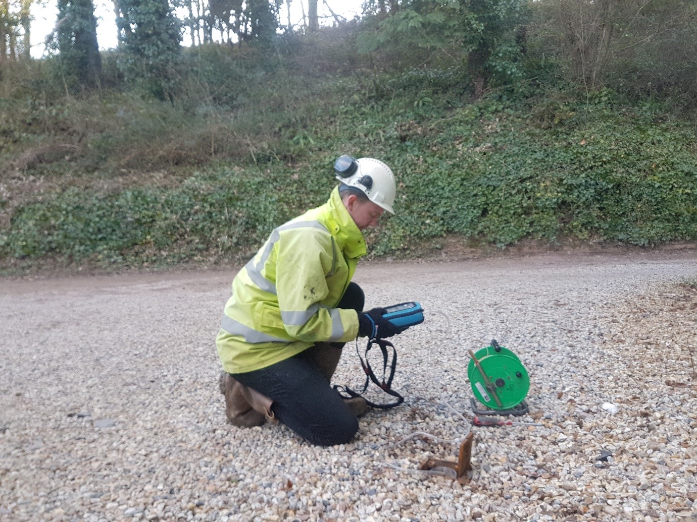
Ground Gas Monitoring - Gas risk assessment for residential development near historic landfills Following identification of several historic and active landfills in the vicinity of a residential development, a gas risk assessment was undertaken to determine the level of gas protection measures required. A series of gas monitoring wells were installed using SWGs very own Dando Terrier window sampling equipment. These were subsequently tested for methane and carbon dioxide using a GA5000 gas analyser. The monitoring indicated there were minor concentrations of carbon dioxide present on site. SWG determined that the concentrations were not elevated enough to warrant specific gas protection measures beyond the basic radon protection already required and the use of sound modern construction practices. This was agreed with by the National House Building Council (NHBC) and development was allowed to proceed with significant cost savings for the client.
1520543130000
Earthworks Managment
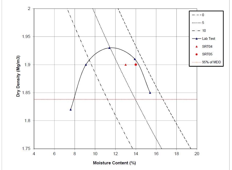
Earthworks management, supervision and compliance testing Following completion of a Phase 2 Ground Investigation Report, SWG subsequently compiled an earthworks specification document in accordance with Highways Agency Series 600 to assist with levelling of a site to allow light industrial units to be constructed with ground bearing floor slabs sited on site won re-compacted fill. SWGs UKAS accredited laboratory and geotechnical site technicians undertook monitoring of the earthworks as filling progressed, including confirming the design California Bearing Ratio (CBR) was achieved by the fill materials. This was undertaken using Plate Load Bearing Test equipment and TRL DCP apparatus. Maximum dry density testing by Sand Replacement method was also undertaken in house, to ensure the materials had been compacted to the required density. An earthworks completion report was then produced by SWGs Ground Engineering team. The works saved the client considerable amounts of money by allowing site won materials to be reused rather than off-sited to landfill. The reuse of materials meant the projects carbon footprint was significantly reduced as there was no need to take the materials to landfill or have trucks import materials to site.
1520542851000
Former Hotel, Newquay
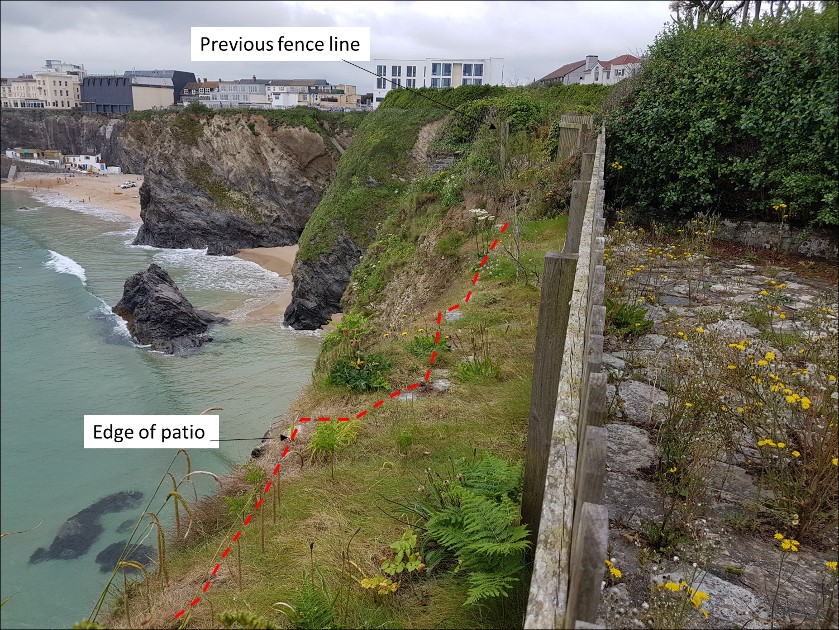
Coastal Stability AssessmentRedevelopment of former HotelCliff tops, Newquay South West Geotechnical Ltd was instructed to undertake a Phase 1 coastal stability assessment to assist with a planning application for the proposed redevelopment of a former Hotel located on the cliff top in Newquay. Development proposals involve the demolition of the existing hotel building and two adjacent properties and the subsequent construction of a series of residential properties on a similar footprint to the existing, with an additional property to the north. The coastal stability assessment concluded that although the global stability of the site is not considered unacceptable (i.e. as a whole the site is intrinsically stable) the upper sections of the cliff are experiencing active coastal erosion. It was recommended that the proposed buildings on the northern and eastern extremities of the site were moved/ redesigned in line with predicted 100 year erosion rates to ensure the long term stability of the structures. A geotechnically focussed site investigation was recommended to provide data for the design of foundations and stabilisation works. Stabilisation works in the form of rock bolts and mesh were recommended along the top of the cliff to prevent further erosion causing loss of the gardens.
1520542476000
Coastal Stability....
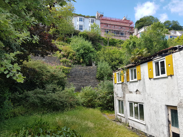
Coastal Stability AssessmentRedevelopment of residential propertyCoastal, DartmouthSouth West Geotechnical Ltd undertook a Phase 1 stability assessment to assist with a planning application for the proposed redevelopment of a property off of, Southtown, Dartmouth, Devon. Development proposals involve the demolition of the existing residential properties and the subsequent construction of an apartment block comprising twelve apartments, with associated parking, communal gardens and swimming pool. The stability assessment concluded that although the mass stability of the site is not considered unacceptable (i.e. the site is intrinsically stable). However, the long term stability of the slope and retaining walls on the western part of the site should be improved prior to construction of the new structure as any stabilisation works will be very difficult to carry out post construction. Stabilisation works in the form of rock bolts and mesh are recommended along the top of the cliff to aid support long term. SWG are continuing to help with this challenging project and will update this case study when the stabilisation works are underway.

1520513169000
Shotwick Solar Park
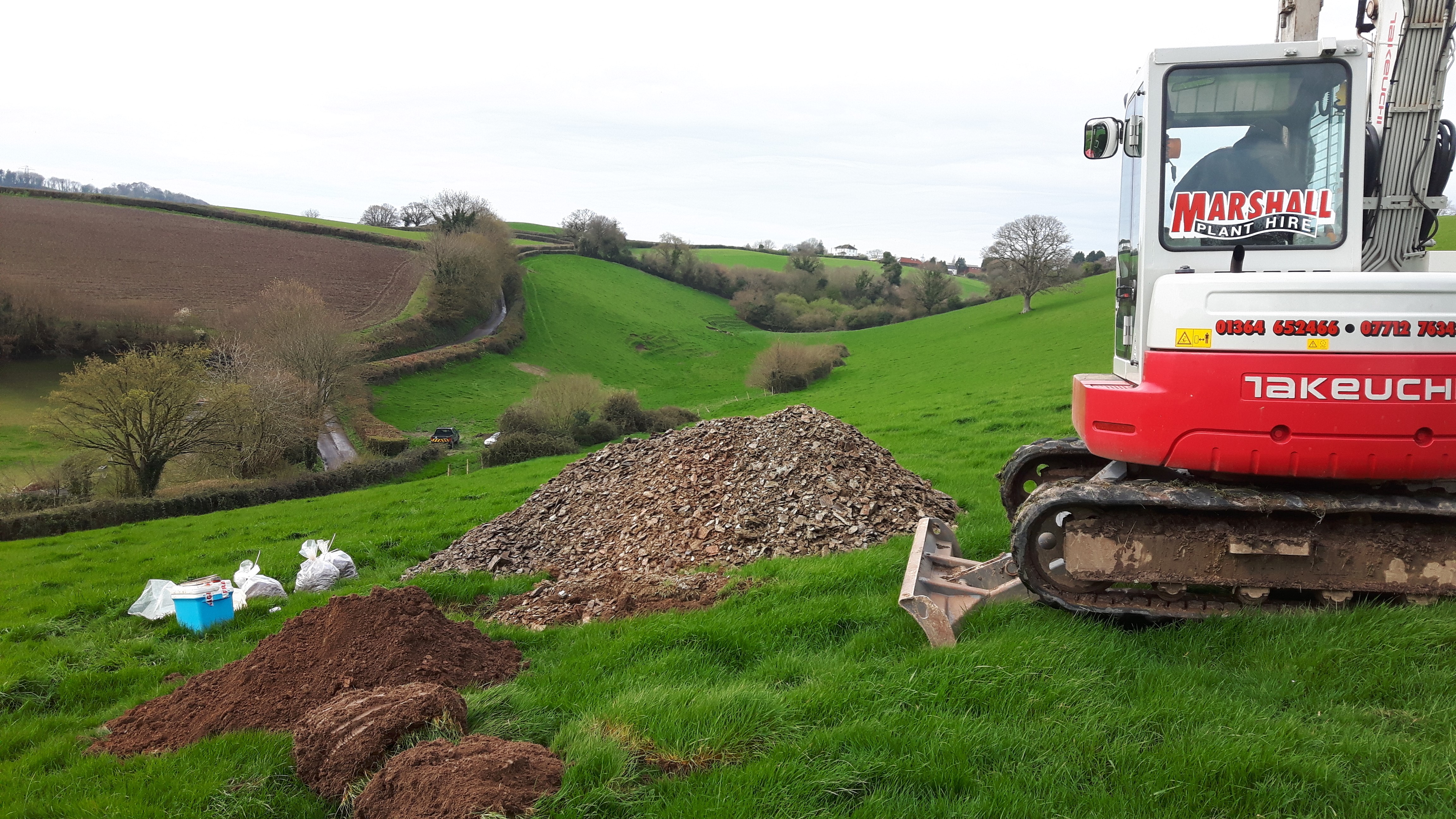
UK’s largest ground mount utility scale solar parkGround InvestigationGeotechnical AssessmentPile testingResistivity TestingPile length optimisationConstruction phase verification / workmanship testing South West Geotechnical was commissioned to complete a ground investigation and geotechnical assessment for a large 74MW ground mount solar park. This site lies on reclaimed land formed from sediment dredged from the River Dee Estuary. A combination of investigative methods, including window sampling, cone penetration testing, pile testing and resistivity testing in conjunction with detailed UKAS accredited laboratory testing in SWG’s in house laboratory helped develop the comprehensive ground model and initial design of foundations. A two-post system was recommended, with relatively high edge table pull-out forces on the north-side piles. Initial pile testing recorded marginal shaft resistance, but rather than increase the pile depth or adopt some other form of anchorage, it was decided to check what strength increase with time might be developed. Three separate test visits gave the following resistance / time relationship for northern edge piles. A full 100% increase in strength was seen to be gained in these soils, after being installed for 100 days, which was more than sufficient to permit the original design to be safely adopted, with significant savings for the client.
1520512442000
New Link Road
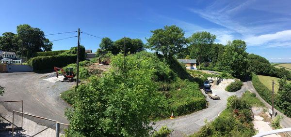
Slope Stability Assessment, Cuttings, EmbankmentsMaterial Classification, EarthworksGroundwaterRoad Pavement South West Geotechnical Ltd, acting on behalf of the local Authority undertook a geotechnical investigation to assist with a new link road to the north of Newton Abbot. The new road bisects a deeply incised valley feature making access challenging. However, with SWGs in house tracked Comacchio 205 drilling rig and help from local contractor Marshalls Plant for the excavators, or drilling team and engineering geologists delivered a successful investigation. SWG designed and completed the investigation, providing detailed ground conditions advice for the design of the road and related infrastructure. The exploratory holes generally encountered a relatively thin mantle of topsoil overlying residual soil derived from the weathering of the Gurrington Slate bedrock. Alluvial soils were encountered at the base of the valley feature. Groundwater was encountered near surface in the vicinity of a proposed cut slope and was considered critical to the long term stability of the slope. To manager the risks, the resulting cut slope requires horizontal drainage holes drilled into the toe to allow the groundwater table to be pushed back to an acceptable distance to achieve an appropriate Factor of Safety. Localised herringbone drainage was also recommended to pick up any perched water. Fill embankments were considered stable at the proposed angles and significant long term consolidation settlement of the embankments was variable but acceptable. Appropriate earthworks were recommended to ensure a good key into the existing sloping ground profile to allow appropriate compaction of fill materials. A cut and fill balance was projected with the re-use of site won fill as either Class 1B or 2C materials in accordance with Highways Agency Series 600 with materials generally close to optimum moisture content. In addition, design CBR values were provided.
1520440131000
Torhill, Marldon
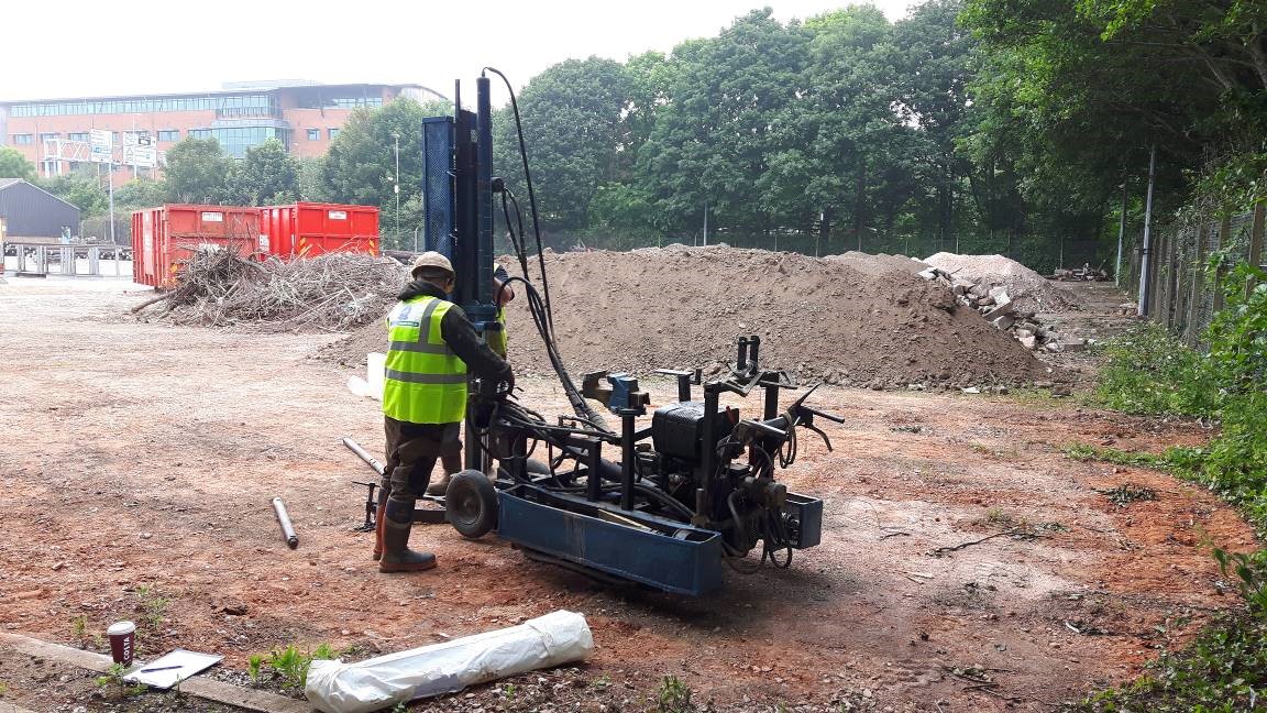
Former Quarry and Cement WorksContaminated Land /Geo-environmental AssessmentGeotechnical Assessment SWG were instructed to scope and complete a comprehensive geo-environmental and geotechnical assessment for the redevelopment of a former limestone quarry and cement works at Torhill, Marldon, Devon The investigation comprised of a focused desk study with a follow on investigation comprising trial pits, boreholes, in-situ testing and monitoring. Related geotechnical laboratory testing was then completed by SWG’s in-house UKAS accredited geotechnical laboratory. All the information was then used to develop a detailed ground model that formed the basis of the geotechnical design and manage the risk of contamination to the environment and controlled waters. SWG helped the client managed the costs associated with the residual contamination on site and the geotechnical considerations relating to foundation design and stability of the former quarry high walls.
1520439733000
WPD Depot, Exeter
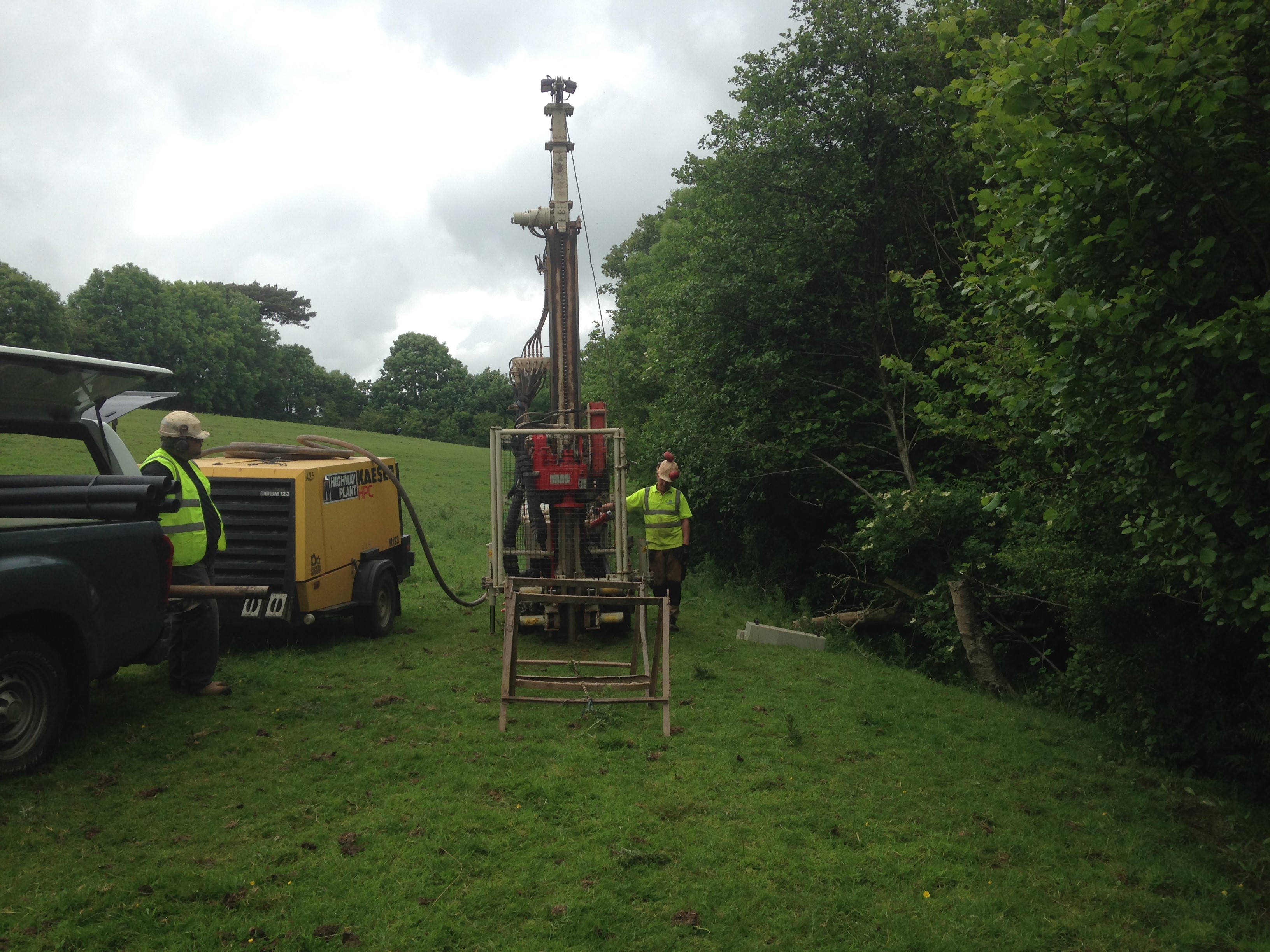
Contaminated Land /Geo-environmental AssessmentGeotechnical Assessment SWG were instructed to scope and complete a comprehensive geo-environmental and geotechnical assessment for the redevelopment of the WPD depot, Exeter, Devon The investigation comprised of a focused desk study with a follow on investigation comprising trial pits, boreholes, in-situ testing and monitoring. Related geotechnical laboratory testing was then completed by SWG’s in-house UKAS accredited geotechnical laboratory. All the information was then used to develop a detailed ground model. This model formed the basis of the geotechnical design and managed the risk of contamination to the environment and controlled waters. SWG helped the client managed the costs associated with the residual contamination on site and the challenging geotechnical considerations requiring novel / alternative foundation solution including ground improvement techniques.
1520439307000
Flood Relief
Site InvestigationGeotechnical designFlood relief earth dams / bundsEarthworks SWG were instructed to scope and complete a comprehensive geotechnical assessment for a series of proposed flood relief dams in Modbury, Devon. The works then led on to geotechnical design, working along side an appointed panel engineer. The design included stability analysis and earthworks. The investigation comprised of a geology and geomorphology focused desk study and mapping with follow on investigation(s) comprising trial pits, boreholes and in-situ testing. Related geotechnical laboratory testing was then completed by SWG’s in-house UKAS accredited geotechnical laboratory. All the information was then used to develop a detailed ground model. This model formed the basis of the geotechnical design that comprised a detailed appraisal of the suitability of site one fill from a permeability, grading and erodibility perspective. RocScience software SLIDE was used to provide the stability analysis. The earthworks specification was complete in accordance with the Highways agency Series 600 earthworks.
1520439027000
Newlands Marina
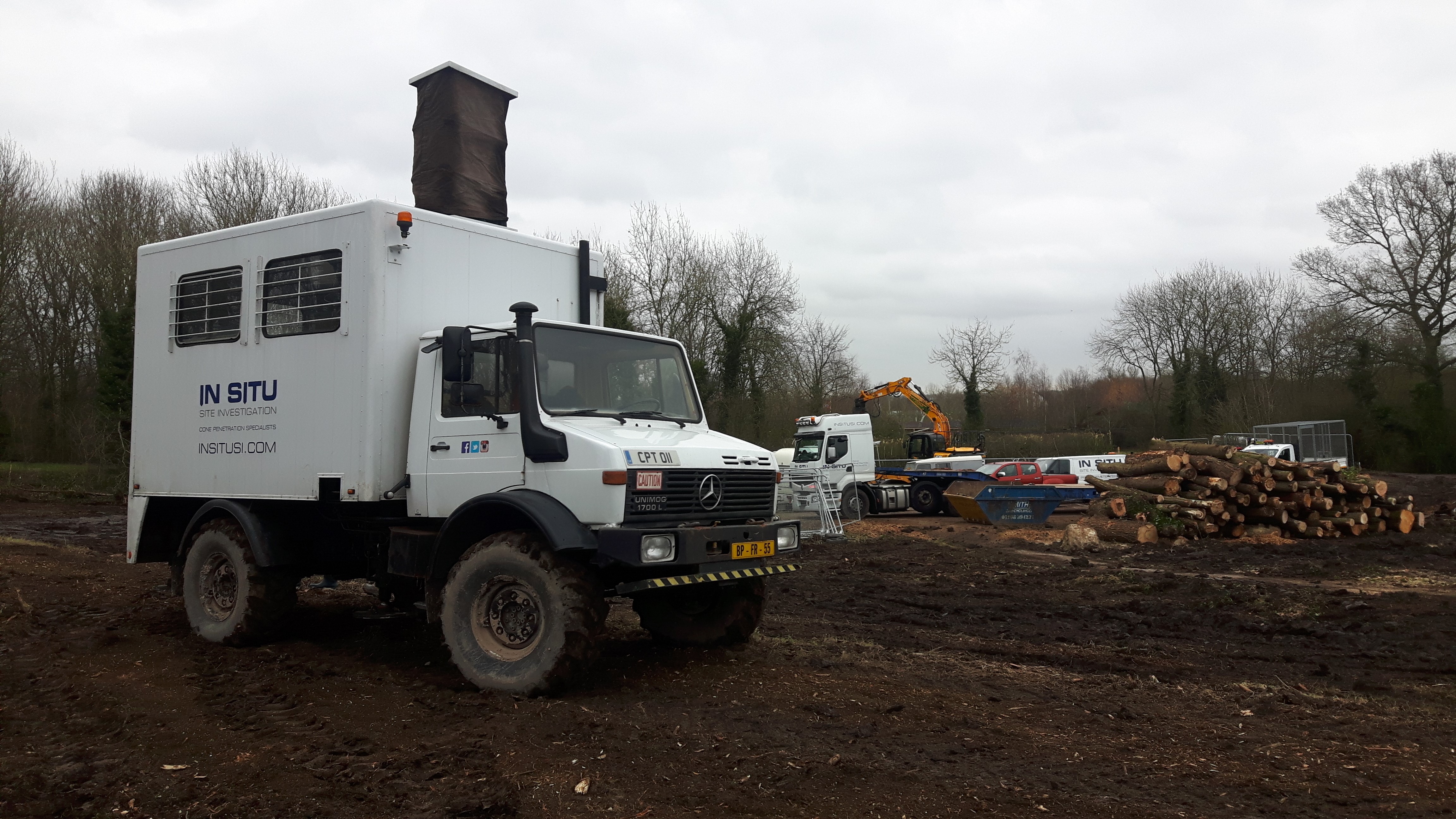
Factual Geotechnical Assessment SWG were instructed by Land And Water Services to complete a geotechnical assessment to help with the design of a new canal-side marina in Milton Keynes. The marina is being constructed adjacent to the existing Grand Union Canal and will provide a turning area and moorings for boats, along with various amenities such as a hotel and shops. A new three-branch bridge will also be constructed to link the eastern and western sides of the canal with the new marina. Information was required to help determine pile design for various buildings, reuse of materials to form embankments, retaining sheet pile design, and bridge abutment design. The investigation comprised two cable percussion boreholes with alternating SPTs and U100 samples, ten trial pits to 3.0m depth and seven CPTu tests. Cable percussion boreholes were suited to the Oxford Clay formation and allowed undisturbed samples to be taken for geotechnical testing, along with continuous strength measurements. Boreholes reached a depth of approximately 15.0m before refusal on limestone. These were undertaken in the location of prosed buildings, for pile design. Trial pits were undertaken over the area of the proposed excavation and allowed bulk samples to be taken for geotechnical testing. This testing was to ascertain the properties of the soils and classification for re-use. Hand shear vanes were also undertaken throughout to give a continuous shear strength profile of the soils encountered. A Unimog CPTu truck was utilised to provide data for the foundation design of the proposed three-branch bridge. A total of seven CPTu probes were undertaken along the line of the proposed bridge abutments. These probes also encountered refusal on hard strata at approximately 15.0m, and gave continuous data throughout the soils. Related laboratory testing was then completed by SWG’s in-house UKAS accredited geotechnical laboratory on sub-samples extracted from the boreholes and trial pits. A factual report was then passed on to the Client, which enabled detailed design work to be carried out.
1520438080000
Mynydd Brombil Wind Farm
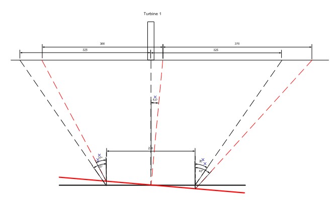
Site InvestigationCoal Mining Risk AssessmentGeotechnical Assessment incl. Foundation Design Following calls from the Local Authority regarding future mining activity, the developer instructed South West Geotechnical to complete a coal mining risk assessment along side a detailed geotechnical assessment for foundation design. Seams beneath the site to a depth of 270m have been the subject of historical mining, and for that reason this effectively sterilised zone would be of no prospecting interest to the mining operator. Therefore, noting that shallower workings have greater surface impact than deeper mining, we considered that the shallowest possible target seam would be the first significant seam (1m thick or greater) below the sequence covered in the Coal Authority’s worked zone is at a depth of 330m. An assessment was then made using the Subsidence Engineers Handbook. It was concluded unlikely that the effects of multiple seams would impact on any one point immediately, unless their working faces were coincidentally vertically above each other. This is because the subsidence wave from an advancing face occurs almost immediately, with just small amounts of creep for a number of years thereafter. However, following consultations with Neath Port Talbot County Borough Council, (NPTCBC) it was decided to assess the effects of all available seams being worked at once. NPTCBC also advised that a 220m wide longwall panel should be considered in the assessment. On this basis, the degree and pattern of subsidence for each seam was assessed individually, with the cumulative effect of the seams being worked contemporaneously also been assessed. The predicted differential settlement was then plotted to ensure any resulting tilt at the base of the proposed turbines could be tolerated. The tilt was then graphically illustrated and discussed in detail. Critically, the assessment went on to conclude “This will ensure that the coal assets remain viable and that the proposed / licensed deep mining operations can proceed uninhibited. This would also mean that a mining exclusion zone is not required.” Thereby satisfying the planning obligations and allowing the developer to proceed with the development.
1520436936000
Sidmouth Beach ...
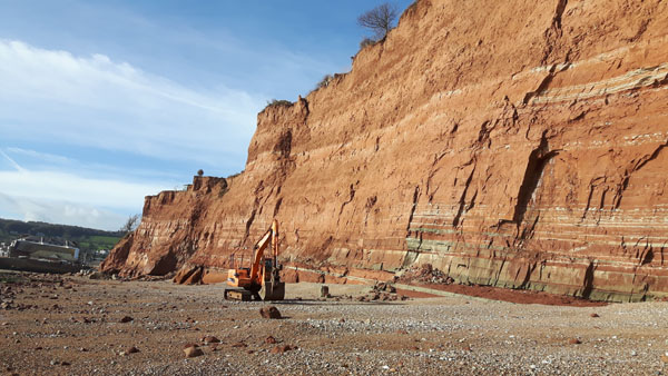
Factual Geotechnical Assessment SWG were instructed by East Devon District Council to complete a geotechnical assessment as part of the Sidmouth Beach Management Scheme. This phase of the scheme involves the siting of new rock groynes and the modification of existing rock groynes and sea wall. The purpose of this work is to encourage sediment recharge on East Beach, in order to help protect the notoriously unstable cliffs along this stretch of coastline. It is hoped that recharging beach sediment will help slow the retreat of this cliff line, saving the gardens of the properties that lie above. The investigation comprised a series of trial pits along East Beach, adjacent to the existing sea wall and the existing Port Royal rock groyne. These pits were required understand the strength, thickness and characteristics of the rapidly changing marine sediments overlying the mudstone and sandstone bedrock below. As vehicular access to the beach was limited to a two hour tidal window each day, organisation and precision was critical to completing the investigation on time. Related laboratory testing was then completed by SWG’s in-house UKAS accredited geotechnical laboratory on sub-samples extracted from the trial pits. A factual report was then passed on to the Client, which enabled detailed design work to be carried out. A feature on local news website Devon Live outlines the plans, here: http://www.devonlive.com/news/devon-news/diggers-continue-work-sidmouth-beach-767294
1520355795000
Carclaze and Baal.....
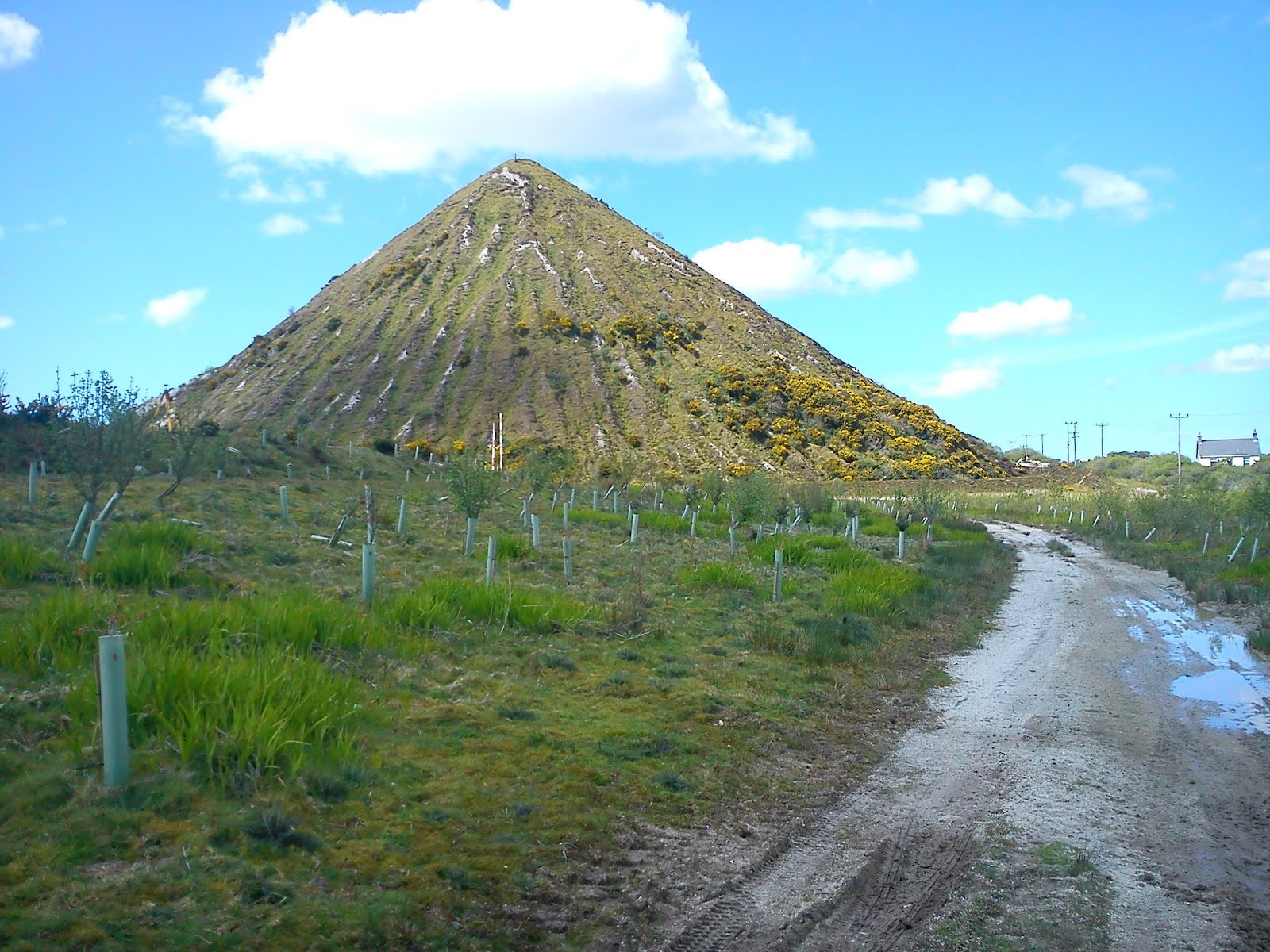
The development site at West Carclaze formed a part of the wider mining landscape within the St Austell China Clay Area and features of the site had been formed through the extensive mining operations undertaken over many years. The West Carclaze china clay area consists of former extraction works, clay pit lakes, a clay refinery (now demolished) and spoil tips, including the Great Treverbyn Sand Tip (known locally as Sky Tip). It was proposed to develop the site to form a new Technology Park that will provide accommodation for hi tech industrial uses. The development included cut and fill to form development plateaus, the construction of new access roads and car parking, SUDS drainage systems and the phased construction of a number of industrial and office type buildings of up to about 3 stories in overall height. A desk study of available geological, environmental and historical data was completed and a site walk over survey conducted to build up a geo-environmental conceptual model of the site so that a risk assessment could be conducted. Intrusive investigation works utilising cable percussion, rotary coring, window sampling, dynamic probing, trial pitting and associated in-situ testing were carried out to determine the geotechnical ground conditions for foundations, earthworks, road pavements and soakaway design. Samples were subject to both geotechnical and geo-environmental laboratory testing. Foundation solutions included piled and vibropiled methods down onto relatively fresh granite. Elsewhere, shallow spread foundations were recommended, both in weathered granite, and on engineered sand fill. Both cut and fill slopes were designed, in both sand fill and weathered granite, using drained shear box tests to establish strength parameters. During the course of the intrusive works a deep kaolinised zone was encountered beneath a large part of the site. SWG were quickly able to mobilise additional equipment to vary the scope to deal with the new ground conditions at minimjal cost and with no impact on programme.
1520354627000
Area 4 South vsc
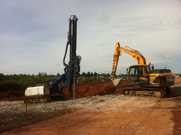
Residential development with marginal near surface ground conditions, Torquay Following an initial ground investigation, near surface soils were not considered suitable for the support of traditional shallow foundations. Due to weathering, the depth to rock head was highly variable meaning the use of trench fill foundations or traditional piles would be complicated and expensive. A fault running through the site further deepened the weathering profile. South West Geotechnical undertook a series of dynamic probes across the site and produced a 3D model of the level of “competent” ground. The marginal ground conditions meant that Vibro Stone Columns (VSC) were considered suitable to support the proposed residential properties. The variable competent ground meant that VSC could be easily and rapidly installed to workable depths. The 3D model was used by the VSC design engineers to optimise lengths of the columns. VSC were then installed rapidly to ensure construction could continue apace.
1501961585000
Solar Park Developments
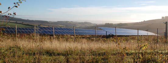
SWG has been involved with large scale solar parks since ~2012. Our involvement in this sector stemmed from the first 'feed-in tariff' wave of developments and our existing relationships with leading renewables firms that were diversifying from wind to solar. Developing our knowledge of the specific design requirements solar parks require helped us understand and meet clients' requirements from geotechnical assessments. We then continued to invest in and develop our in-house capabilities to enable us to provide a comprehensive service to this industry as it grew. This included developing our own innovative and cost effective pile testing methods and detailed corrosively assessments. To date we have completed hundreds of large scale solar parks across the UK and Europe. These have ranged from <1MW to >250MW in size, including the UK's largest solar farm. Looking forward, a lot more of the favourable development sites have been taken up and focus is now turning to more challenging sites such as former coal mines, brownfield land, soft peat areas etc. The SWG team uses out traditional geotechnical understanding, our experience of developing solar parks across the UK and our innovative approach to help developers overcome these challenges and deliver cost effective, engineering led schemes. Our scope of work is summarised below: Desk studies / initial site appraisalsWindow sampling / dynamic probingPile testing (both discrete and full scale)Electrical resistivity testingThermal resistivity testingTrack designFoundation recommendations for ancillary structures (DNO / sub-stations etc)Corrosion AssessmentsSoakaway testingLand quality / contamination assessments References from leading solar developers, technical assessors and EPC’s can be provided on request. Please get in touch to see how we can help.
1501958992000
Peat Permeability
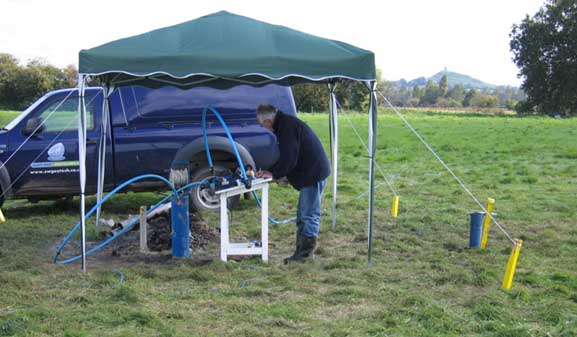
It was proposed to exploit a new peat working close to an existing isolated house on the Somerset Levels. Due to concerns of the impact of groundwater drawdown due to the workings on the house foundations, it was necessary to model what would occur in this process. Fundamental to establishing this impact was determining the permeability of the peat. This was achieved by long term full scale pump tests. The test set up, including control console and monitoring boreholes are shown in the graphic below: Graphical data was produced that could be read to establish permeability values by a number of different methods: Methods of AnalysisData from all the monitoring wells was analysed using the Thiem-Dupuit method given in Kruseman and de Ridder (2000). Classical equation given in all text books; Q = pk (h22 – h12)/ (ln (r2/ r1) or k = (2.3Q/ p (H22 – h12)) x log (r2/ r1) Some were analysed using the Theis Analysis (BS5930, 28.3.2.2), which uses a plot of observation well drawdown compared or superimposed on a Theis 'type-curve’. Depending where the test curve falls on the type curve, parameters are read off the type curve, and substituted in equation to determine k. The four nearest monitoring holes were also analysed using the Cooper-Jacob Time Drawdown Method (BS5930, 28.3.2.3). Using this method, the drawdown over a log cycle of time on a straight line portion of the graph is determined, and substituted into an equation to derive k. The same method can be used plotting drawdown against log distance Cooper-Jacob Distance Drawdown Method from the well at a given time. Drawdown/ distance between the four nearest holes to the pump well were plotted to determine the unit drawdown value. The recovery phase of PW01 and near wells was analysed using Theis’s Recovery Method (Kruseman and de Ridder, 2000, 13.1.3). A semi log plot of residual drawdown against time after pumping ceased is plotted, which gives a straight line, the slope of which = 2.30/ 4pKD The recovery of PW01 after the step test was also analysed by this method. Rising head permeability tests (BS 5930) were carried out in all of the boreholes put down as part of this exercise both to determine k, but more importantly to check uniformity of conditions across the site. Once a characteristic permeability value was determined, the extent of drawdown could be accurately predicted, and modelled. The testing demonstrated that the nearest property to the working would in fact remain unaffected, and this permitted the extraction to proceed safely.
1501957116000
New Housing Development
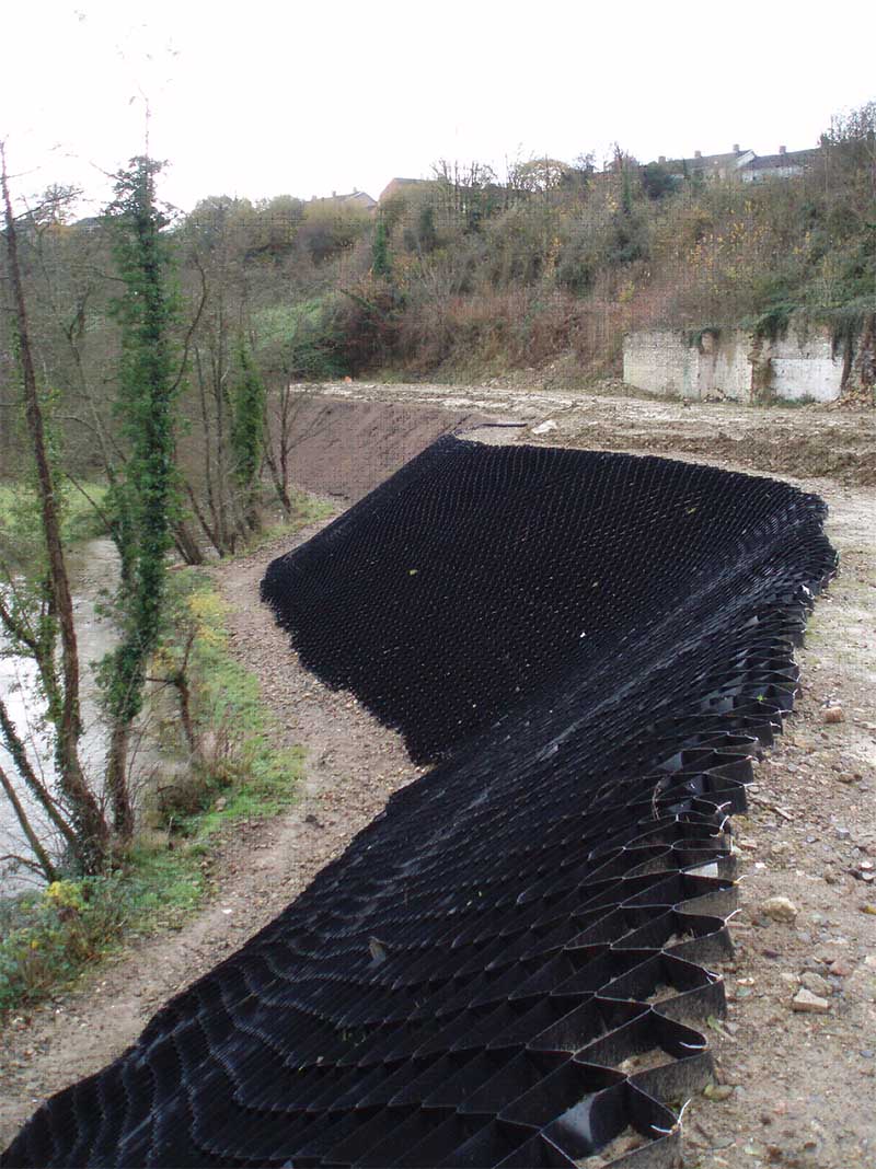
A new housing development was proposed on a former heavy industrial site in Frome, Somerset. Before development could proceed, the site needed to be levelled by importing soil to upfill low areas by as much as 7 metres, and a 6m high reinforced fill slope built to bound the adjacent River Frome. A variety of foundation solutions were then designed to suit the various geotechnical scenarios within the reformed site. South West Geotechnical scoped and implemented the ground investigation, and designed and supervised both the earthworks and reinforced fill slope subsequent to carrying out long term settlement monitoring of filled ground. The ground investigation comprised 6 cable percussion boreholes, 20 rotary drillholes and 30 trial pits, with associated laboratory and in-situ testing, all carried out with our own resources. Earthworks monitoring included initial compaction trials on various prospective fill materials to assess optimum compaction requirements, and the checking of compacted fill for in-situ density and strength requirements as filling proceeded. This was done by sand replacement density testing, plate bearing testing, and laboratory triaxial shear strength determination. After completion of earthworks laying, a 12 month settlement monitoring programme was initiated, to delineate areas of the site where long term settlements would be sufficiently low to permit the use of shallow spread foundations, and those that would require deep (piled) foundations. Levelling was undertaken with precise digital optical equipment, and a levelling staff designed to have minimal length-change potential with variations in temperature. The equipment enabled a degree of accuracy of less than 1mm to be achieved.
1501588800000
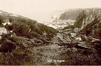
Rocky Lane, St Agnes Eco Lodge DevelopmenT
SWG were appointed ground investigation and geotechnical design engineer for the development of 12 high specification timber lodge houses perched on a mined steep valley side overlooking Trevaunance Cove, St Agnes. The site represents one of the biggest geotechnical challenges in the south west, with major issues including: Ground contaminated by both natural and mining processesUnrecorded mining voids including adits, shafts and lode stope workingsRock slope instabilityFill slope instabilityDeep foundation requirements Following detailed investigation, solutions designed to overcome these site specific problems have included: Inert capping layers to isolate contaminated fillFilling and grouting of worked stopesCapping of mineshaftsRe-profiling fill slopes with geogrid reinforcementSupporting new cut slopes with soil nails and shotcrete or proprietary mattingSupporting unstable rock slopes with anchors and heavy duty meshingRock-socketed piling to support new structures. Mining features identified from historical records and photographs. Typical geotechnical works included soil nailing, shotcreting and erosion protection associated with stabilising proposed plot. Capping of mineshaft
PROJECTS